FLASH FLOOD WATCH IN EFFECT FROM LATE TONIGHT THROUGH SUNDAY MORNING:
Greene IL-Macoupin IL-Montgomery IL-Bond IL-Fayette IL-Clinton IL-Marion IL-Washington IL-Adams IL-Brown IL-Pike IL-Calhoun IL-Jersey IL-Madison IL-Saint Clair IL-Monroe IL-Knox MO-Lewis MO-Shelby MO-Marion MO-Monroe MO-Ralls MO-Pike MO-Boone MO-Audrain MO-Moniteau MO-Cole MO-Osage MO-Callaway MO-Montgomery MO-Lincoln MO-Gasconade MO-Warren MO-Saint Charles MO-Franklin MO-Saint Louis MO-Saint Louis City MO-Jefferson MO-
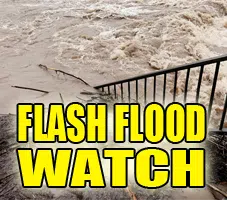
The National Weather Service in Saint Louis has issued a Flash Flood Watch for portions of Illinois and Missouri…
* From late tonight through Sunday morning
* The remnants of tropical depression Gordon will interact with a cold front stalled across Missouri and Illinois. Rich tropical moisture from Gordon will produce very heavy rainfall across the watch area starting late tonight and continuing into the weekend. Rainfall amounts of 3 to 6 inches are likely with locally higher amounts.
* Heavy rainfall will result in flooding of low lying or poor drainage areas…and ultimately dangerous flash flooding on smaller creeks and streams. Significant rises on larger
streams and rivers will also be possible.
PRECAUTIONARY/PREPAREDNESS ACTIONS…
A Flash Flood Watch is advanced notice that conditions are favorable that may lead to flash flooding. People in the Watch area, especially in flood prone areas, should use this time to make preparations just in case. Stay informed, and be ready for quick action if flooding is observed or if a Flash Flood Warning is issued.


